


Brazil is a Latin American country with a population of around 209 million people. Most Brazilians live in the cities of Sao Paulo, Rio de Janeiro, and Brasilia with a majority speaking Portuguese as their main language. Portuguese is also considered the official language of Brazil.
Brazil is the largest country in South America and the fifth largest country in the world by area. Brazil is home to many different climates, ranging from tropical rainforests to the cold and dry desert of the south. It is a diverse country with a strong culture and a large economy. The country is the world’s tenth-largest economy by GDP and is a major exporter of commodities like iron ore, soybeans, and coffee.
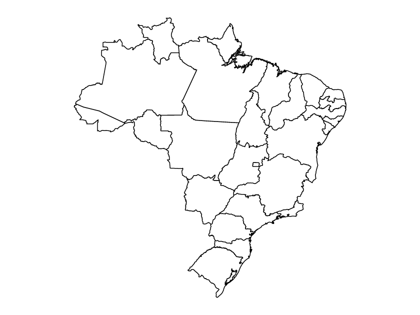
What is a blank political map of Brazil?
A blank political map of Brazil is a map that shows the country’s political boundaries, with no labels or other markings on it. It simply shows the shapes and outlines of each state in Brazil, without any other information. Political boundaries can also be termed as administrative divisions. Administrative divisions are regions divided by the government for the purpose of governing, taxation, and providing services to the population.
Administrative divisions of Brazil
The Brazil map shows the states of Brazil or first-level administrative divisions. These were formed on December 15th, 1889, with the country being divided into 26 states and one federal district. The states of Brazil are also called Estados, and the capital of each state is called the Cabecera. Each state has its own government, legislature, and constitution. The federal district, Brasília, is the seat of the federal government.
The states are further divided into municipalities (municípios), which are the smallest administrative divisions in Brazil. The municipalities are responsible for local services such as health care, education, public safety, and infrastructure maintenance.
List of states of Brazil
- Federal District
- Acre
- Alagoas
- Amazonas
- Bahia
- Ceará
- Paraíba
- Espírito Santo
- Goiás
- Maranhão
- Mato Grosso
- Rio Grande do Norte
- Mato Grosso do Sul
- Minas Gerais
- Pará
- São Paulo
- Pernambuco
- Piauí
- Amapá
- Rio de Janeiro
- Paraná
- Rio Grande do Sul
- Rondônia
- Roraima
- Santa Catarina
- Sergipe
- Tocantins
How to download Brazil’s political map
To download this map for free, click the “Download” button on the right side of this page. After you have clicked the download button, you will get a popup with an attribution link and a download button. This should give you access to a zip file. After you have downloaded it, extract the zip file and enjoy. Make sure to provide attribution when using the map on the web.
Available map formats
Within the zip file, there are three map formats: PDF, SVG, and PNG. PDF files are vector images that can be printed or used for digital purposes. The SVG files are vector images that can be edited with a vector graphics editor, such as Adobe Illustrator. While the PNG format is useful for blog posts, and print media, such as posters or flyers.
How to edit the map
If you want to edit the SVG map of Brazil, you will need to use a vector graphics editor such as Adobe Illustrator, Inkscape, or CorelDRAW. These programs allow you to manipulate the shapes and lines that make up the map, as well as add labels and other information. Once you have made your changes, you can save the file in the SVG format to preserve the vector graphics. You can also export to multiple file formats
How to print the political map of Brazil
To print the PDF map of Brazil, open the file in a PDF viewer and select the “Print” option. You can then select the printer, paper size and orientation, and other printing settings. Alternatively, you can save the file to your computer and then open it in a program like Adobe Photoshop or GIMP to edit and print.
How can you use this map?
The blank political map of Brazil can be used as a reference in a variety of ways. It can be used as a teaching tool to help students learn about the states of Brazil. It can also be used to identify regions and compare the size and shape of the States. Also, cartographers can use it as a starting point for creating more detailed maps that include roads, cities, and other geographical features.